
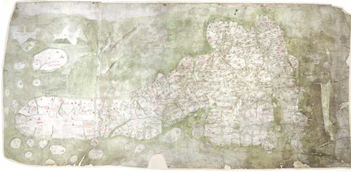
This is a quick post to mark the online availability of the Gough Map of Great Britain, the earliest surviving medieval map of Great Britain!
According to the University of Oxford, the Gough Map of Great Britain was probably made somewhere back in 1375 by at least two scribes (map makers); the original scribe possibly came from the 14th century and some portions of the map was later revised by another scribe in the 15th century. However, their exact identities could not be determined but the University of Oxford has learned a lot about the Gough Map of Great Britain and you can read more about their discoveries from their official press release (you can find the link at the bottom of this post).
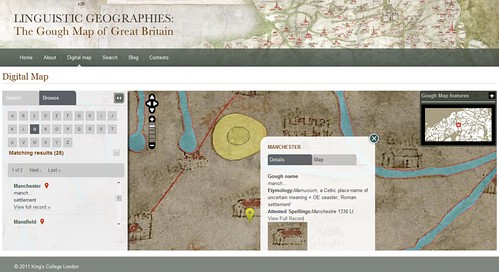
You can play around with the online, digital version of the Gough Map of Great Britain. Some basic map navigation tools have been provided and the online, digital map is fully searchable. You may browse the map by its modern and medieval place names and each place name has a pin on the map (something like the ones you see on Google Maps). You may click on the pin to get even more information about the chosen place name.
Via University of Oxford


0 comments:
Post a Comment