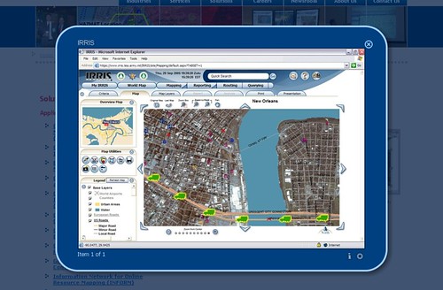
GeoDecisions, a well known leader in geospatial solutions, has launched IRRIS 7 earlier today. What is IRRIS? What can it do? What does it offers? Read on for more.
GeoDecisions has launched IRRIS 7
IRRIS is the very application used by the American state and federal agencies to track and monitor transportations and infrastructures. The application integrates worldwide infrastructure, route conditions, real time vehicle tracking and weather data on a single map from more than 400 data sets.

GeoDecisions believes their new IRRIS 7 application has tremendously transformed the way users perform their daily routines. IRRIS 7 is much more powerful and productive than previous versions. It was built on the robust ArcGIS 10 platform and fully utilizes the Flex API., offering faster map creations and data queries. IRRIS 7 also offers improved cache management and optimized graphics, providing smooth panning of data on screen. Unlike previous versions, IRRIS 7 no longer forces the application to load a new page after changes are made by the user and GeoDecisions believes this is one of the most significant improvements made to IRRIS 7. This also means that users can add and remove layers without refreshing the page. Existing IRRIS users can be assured of significantly improved workflows with IRRIS 7.


0 comments:
Post a Comment