geOps OpenLayers Editor source code released! Under FreeBSD!

Here’s a little good news for GIS developers.

geOps has released the full source code of their cute little geospatial editor called OpenLayers Editor under the FreeBSD license!

OpenLayers Editor is really cute and it comes with a toolbar that has some basic tools to help users edit and manipulate geodata right from their browsers. You may digitize lines, polygons and even place points with OpenLayers Editor. The cute little web app even allows you to upload shapefiles, split, merge and validate geometries (with the help of PostGIS).

geOps has been kind enough to provide us with a demo site and you can play around with OpenLayers Editor there. GIS Developers may also download its source code from Github.
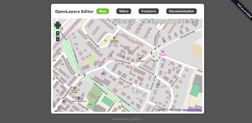


OpenLayers Editor
Subscribe via RSS or Email:

Related Posts


0 comments:

Post a Comment

  • Commenters are encouraged to leave comments via OpenID but if you have problems in leaving one via OpenID, please refer to this excellent guide.
  • Comments that add tremendous value to the blog post will not only get approved but also will be personally tweeted (learn how!) by the blogger behind this blog, giving commenters the opportunity to get even more traffic and gain even more exposure to their sites or blogs.
  • Comments that have links in the bodies of comments will never be approved.
  • Preferably comments should be made in English but comments in other languages are also acceptable.