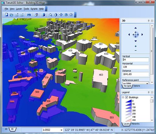
This is just a quick post to announce the release of TatukGIS Editor 3.0 that is packed with even more powerful and robust 3D mapping capabilities. What is TatukGIS? What does the new version has to offer to GIS professionals? Read on to find out.
TatukGis Editor 3.0 released! Comes with 3D Mapping capabilities
TatukGIS Editor is a fully customizable, programmable desktop 3D GIS mapper and data editor that support numerous image, vector, grid and database formats. The app even comes with more or less 3,000 pre-defined coordinate systems, allowing users to reproject maps with one click on the button.
The new TatukGIS Editor 3.0 offers seamless 3D viewing experience, 3D presentation of DTM (Digital Terrain Models) and 3D vector rendering. Everything is customizable and programmable, allowing users to control the angle of the camera, lighting conditions and simulations. The new version even renders 3D maps much faster than previous versions and when it comes to rendering huge datasets in lightning speed, TatukGIS is one of the best there is. A trial version is available for download, give it a try. :)


0 comments:
Post a Comment